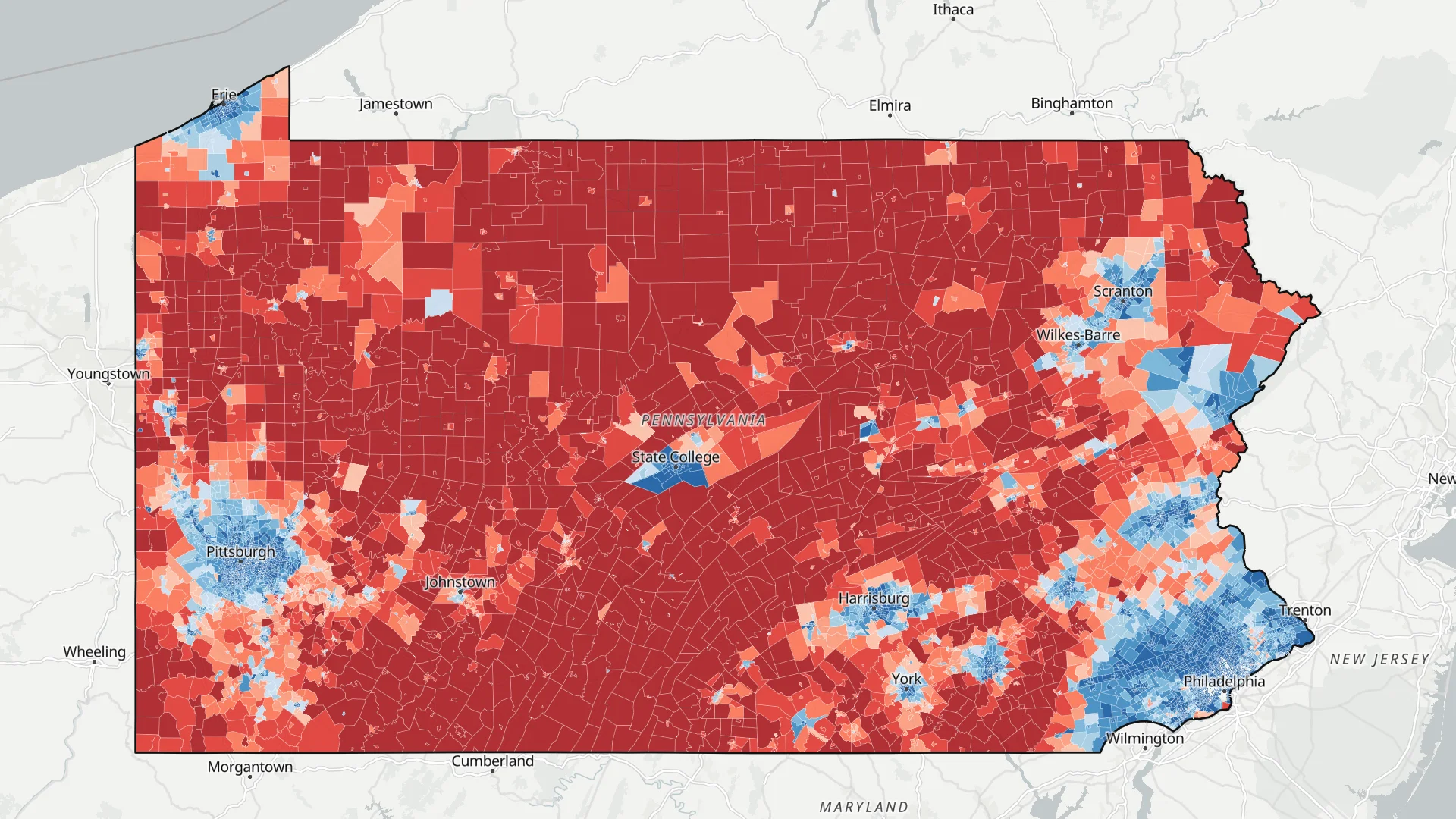
An interactive map and table of every precinct result from Pennsylvania’s 2022 and 2024 general elections: 13 races, from President and Governor down to the State House, across roughly 9,100 precincts in all 67 counties.
The hard part
Precinct lines change between elections, so results reported on one year’s lines don’t line up with another’s. I re-aggregated the Department of State’s precinct returns onto current precinct boundaries, assigning each older precinct to the current one that holds most of its area, so every race shows on the same map.
Congressional lines also cut through some precincts. Rather than shading a split precinct with votes from two different races, the map cuts it along the district line and shows each piece with its own district’s result.
What you can do with it
- Shade the map by any race, by margin of victory
- Add results up by county, congressional, State Senate or State House district
- Search, sort and filter the full results table by county, municipality, district, winner or margin
Built with
TypeScript, Vite and MapLibre GL for the site; Python, GDAL and QGIS for the data pipeline.